


These maps are fantastic!!
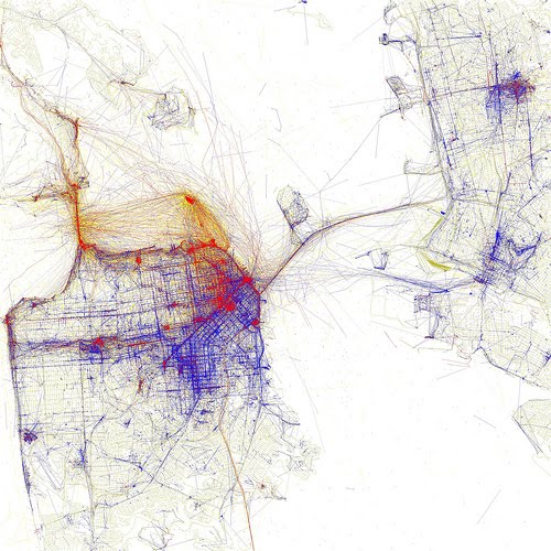
Eric Fischer overlays geolocation data from photos uploaded to Flickr and Picassa and places it onto maps. All this to find out who takes photos of a city - locals or tourists - and of which parts.
Blue - photos taken by locals
Red - photos taken by tourists
Yellow - might be either
Have you recognized which cities I have posted? It's too easy, no?
The first is Paris. The second is San Francisco. The third is London. The fourth is New York. Fischer has now got 99 of these maps on his link. Go find your city!
I love this map, they are amazing !
ReplyDeleteEven the color card is cool.
It's beautiful!
ReplyDelete